
Directions: The directions to Girdner, Roundabout, Remnant loop trail from downtown Sedona.
Head west on N State Rte. 89A towards Upper Red Rock Loop Rd
At the light, turn right
Go straight until you see the parking area on your left
About the hike: This is a 2.7-mile loop with an elevation gain of 219 feet. I'd rate this trail as moderate because, along the remnant trail, I felt challenged with walking along the mountainside with a sheer drop off to my right.
You'll start on the Girdner trail, which is primarily flat and has beautiful views in the background.

The challenging part on the trail was navigating all the lose rock.

The best part of hiking along the Girdner trail are the beautiful periodic peek-a-boo views through the trees.

The Girdner trail crisscrosses multiple other trails. The first crossing point is the Axis trail. Make sure you continue hiking straight down the small incline instead of turning right.

This section of the trail weaved through Ponderosa and Pinyon Pines. It will be the perfect place to grab a reprieve from the sun in early summer when things start warming up again.

Between the trees, you could see the red rocks of Boynton Canyon standing proudly off in the distance.
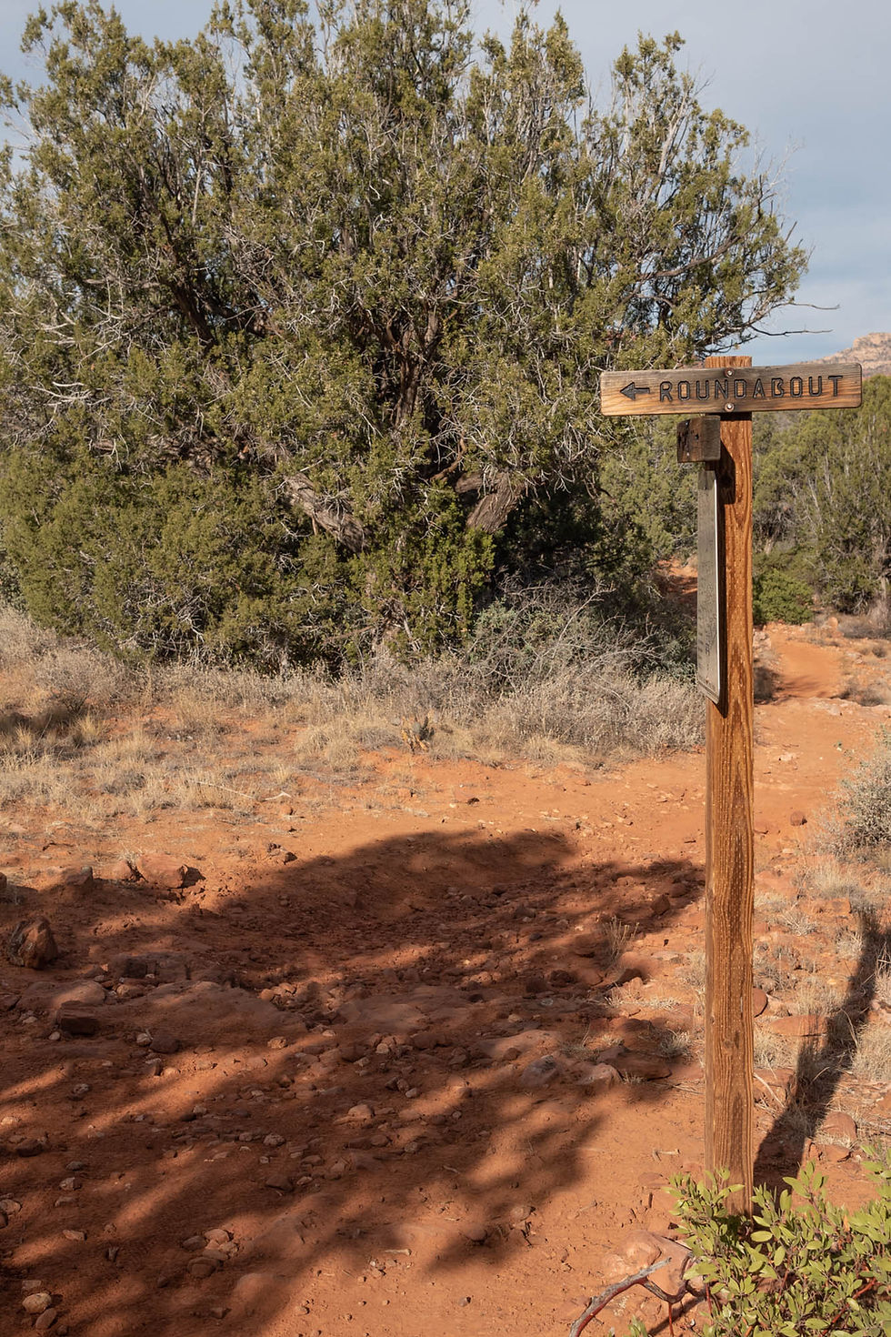
About 3/4 of a mile in, you'll come to the roundabout marker. Ignore this marker and continue straight along the Gridner trail. The roundabout trail is the last trail you'll take on this loop.
The trail gets tricky, especially finding where to turn to begin climbing up the Remnant trail. The trailhead is off to the left, leading up a slight incline by the signpost.

You'll know you missed the trail if you start descending downward along the path. I know this from experience because that's precisely what we did.
This was my least favorite part of the loop and not for the faint at heart. The trail starts winding along the lower portion of the mountain.

It continues winding upward as you hike towards the far south side of the mountain. On this side, the path becomes narrow with a steep dropoff.

I remained focused on this portion of our hike, keeping my footings secured. I don't know what views I may or may not have missed. I was relieved once we were on the backside of the mountain, where we began to wind downward towards the base.
A mountain biker sped past while I was examining a rock.

I noticed a cluster of rocks with hundreds of small holes.

I took a picture to remind me to research the cause. Based on my reading it seems these pock marks are made from escaping gas from beaneath the seafloor hundreds of years ago. It's so fastinating to think about the impermanence of life and how everything shifts and changes over time.
Eventually we came to the roundabout carin and hooked a left up the trail. I certainly didn't want to loop the Remnant trail again. The roundabout was an easy flat trail back towards the trail head. This section of the loop wasn't scenic but I didn't mine, I just enjoyed the easy walk back to the trailhead.

The last 1/4-mile you have the option of taking the paved Centennial trail. I highly recommend taking this easy route.

Back at the trailhead, we rested at a picnic table in the ramada to enjoy the views before heading home.

Comentarios